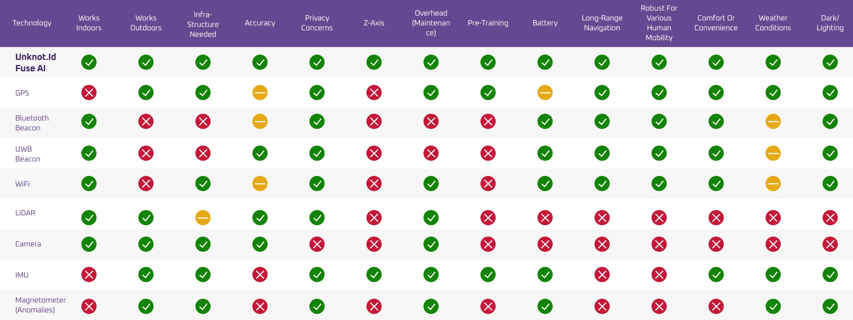
Fuse AI™ is built using a pioneering multi-sensor approach that leverages existing noisy tracking signals to derive valuable insights. Our AI learns and combines multiple sensory signals to deliver accurate and reliable 3D positioning and navigation where other systems fail.
<1 meter error rate
Software based, no additional hardware required
Operates seamlessly in GPS-contested environments

Fuse AI™ feeds a continuous stream of raw data through our cloud-based AI system to enable 3D positioning, navigational context, and spatial awareness.
Fully software-based, our multi-sensor approach leverages all possible available signals to create a more comprehensive and reliable tracking system, allowing it to continuously learn your contexts and surroundings – and work seamlessly in environments where other solutions fail.
Fuse AI™ is composed of four key elements:
Never lose the blue dot, regardless of your environment. Our software works indoors and outdoors, from underground parking lots to forests and caves.
Track your people or assets’ exact floor location. Our software enables multi-level tracking with precise 3D positioning.
Eliminate the need for expensive beacon installations or heavy hardware. Our software integrates with legacy tech to remove the need for new infrastructure.

Fuse AI™ is easy to integrate, install, and start using – with no setup costs or hardware requirements:
Download and install our device SDK.
Integrate with your mapping system from Google, Apple, or other systems like ESRI.
Connect to our Cloud AI for real-time 3D positioning.